
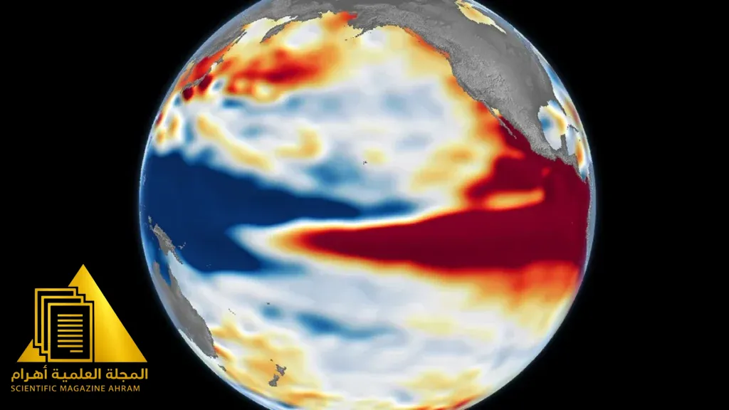

A Journey into the Deep Ocean from Space
For thirty-five years, satellites orbiting in space have continuously monitored our planet with remarkable precision. Today, thanks to this vast data archive, scientists can track the famous El Niño climate phenomenon and compare its current impacts with the most powerful storms that struck Earth in past decades. This technology has given us a unique window into how our planet is changing.
What Is El Niño and How Do Satellites Monitor It?
El Niño is a natural climate phenomenon that begins with unusual warming in the waters of the tropical Pacific Ocean, resulting in massive disruptions to weather patterns around the world, causing drought in some areas and devastating floods in others. For many decades, monitoring these changes was difficult and costly. However, with satellite sea surface height measurements coming into service, researchers can now see the “swell” on the ocean surface caused by the expansion of warm water with centimeter-level precision.
Comparing Past and Present to Understand the Future
The 35-year historical record allows scientists to make precise comparisons between the El Niño we are seeing today and major past historical events, such as those that occurred in 1997 and 2015. These comparisons not only help us understand the power behind the current phenomenon, but they also help climate forecasting models improve their accuracy, giving humanity enough time to prepare for severe climate changes and protect threatened agricultural and coastal communities.
By: Hany Sallam
Source: NASA


Latest video
تابع معنا تحليل قراءة الصحف اليومية مع الكاتب الصحفي Hany Sallam عبر